


Environment Agency to create laser map of England to help fight waste crime
The Environment Agency (EA) announced plans before the end of the year (30 December) to map England’s landscape in its entirety by 2020 and will use the data for a number of applications, including to help combat waste crime.
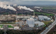
 Using aircraft equipped with specialist laser scanners, the EA will map all 130,000km² of the country, and use the data to better understand flood risk and inform conservation work, as well as fight waste crime by spotting sudden environment changes that could indicate illegal dumping of waste.
The data will be made publically available and free to access for both the public and industry to be used by people such as archaeologists, environmental and urban planners and even gamers to make accurate 3D models of the landscape.
The new project will begin this winter and will extend the mapped coverage of England beyond its current 75 per cent, covering all of the country’s national parks, areas of outstanding natural beauty (AONBs) and sites of special scientific interest (SSSIs).
The EA will use lidar (light detection and ranging) technology to carry out the project, a technology it has used for around 20 years to better understand flood risk. Maps are created through measuring the distance to the ground from aeroplanes using laser scanners.
The extension of lidar data, 11 terabytes of which were made public as open data by the EA in 2015, will be welcomed by those dealing with waste crime; the mapping will make it possible to spot sudden environmental changes that could indicate illegal waste dumping, as was the case in Cornwall in 2014, when eight people were fined for dumping 4,500m³ of waste, discovered using lidar data.
The new data, which is also used by Natural England to assess wildlife habitat and by the Forestry Commission to understand more about the country’s tree cover, will be of better quality than before, with the whole country to be mapped at a resolution of 1m, using the latest laser technology to reveal the features of the terrain more clearly.
Sir James Bevan, Chief Executive of the Environment Agency, said: “This ambitious project will enhance our understanding of England’s unique natural features and landscape, helping us to better understand flood risk, plan effective defences and fight waste crime.
“I’m pleased we are able to gather, use and share such valuable data to contribute to environmental improvements and conservation. It’s just one of the many ways the Environment Agency is using technology to help people and wildlife.”
The new data’s potential application in the fight against waste crime is a welcome addition to the arsenal of options available to waste enforcement officers in the fight against what Bevan dubbed ‘the new narcotics’ back in 2016.
With over £600 million lost every year by the waste industry and the taxpayer due to waste crime, calls have been made to increase regulation to reduce the losses made in clearing up illegally dumped waste, while Chancellor Philip Hammond, in his Autumn Budget statement in November, committed an extra £30 million of funding over the next four years to help the EA crack down on waste crime. 

